Volume vs. Density
Central Precinct emerges as the true intensity hotspot when normalized for land area.
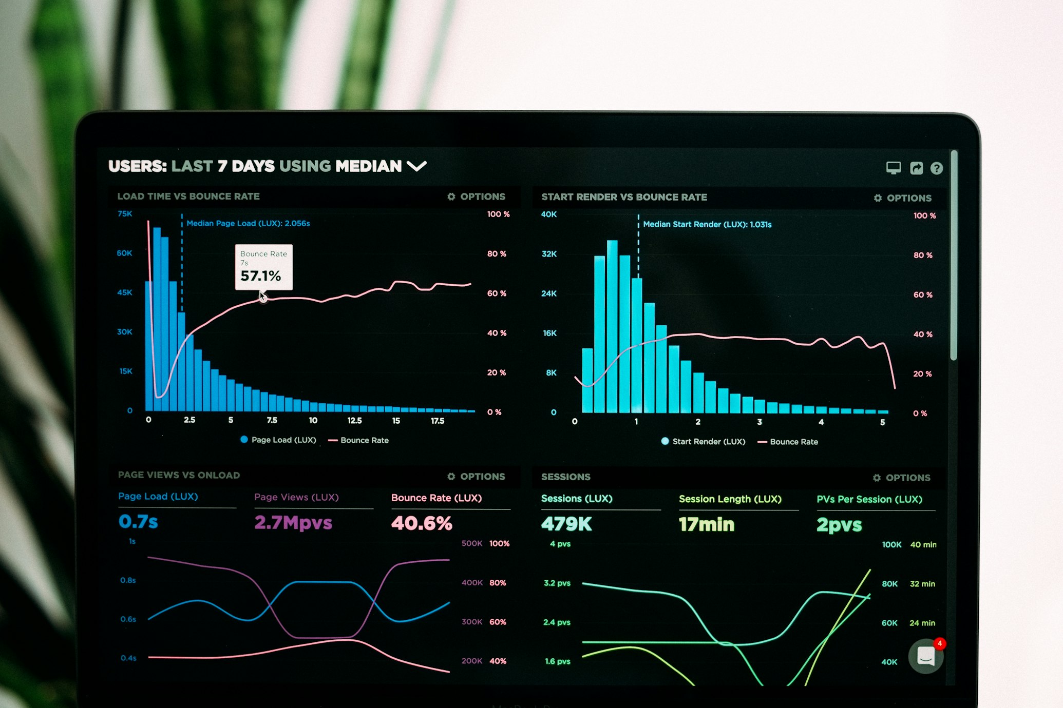
I turn raw data into actionable insights. Browse my Tableau portfolio to see how I apply UCR standards and spatial analysis to reveal patterns in Los Angeles crime, and how I analyze flight delays and cancellations to surface seasonal traveler behaviors and the impacts of airline operations.
Normalizing crime data by geography reveals true “hotspots” and exposes disparities between property and violent offenses. This project challenges the "volume bias" of traditional crime maps.
Central Precinct emerges as the true intensity hotspot when normalized for land area.
Hispanic communities disproportionately bear 51% of violent crime incidents.

Ten years of FAA and DOT data transformed into actionable intelligence. This analysis disproves the assumption that bigger airports always cause longer delays.
Delay rates follow a predictable seasonal "W" shape, validating 10-30% volume fluctuations.
Airlines use cancellations as a strategic tool to protect schedules, independent of delay length.